
Conestogo River flows
- Learn how to read our River and stream flow charts, and our Reservoir charts.
- Many timeseries can be downloaded from our Data Downloads page.
Brochure
- Drayton: Preparing for Flooding - Published by the GRCA in co-operation with the Township of Mapleton and the OPP.
Critical flows
| Gauge (Community) | Flow (m3/s) | Significance |
|---|---|---|
| Upper Drayton/Drayton | 0.1 | Normal summer low flow |
| 125 | Water at banks; low-lying areas flooded | |
| 125 - 200 | Warning Zone 1 | |
| 290 | Flooding behind Wood St. homes | |
| 200 - 300 | Warning Zone 2 | |
| 370 | Water crosses Wood St. | |
| 300 - 400 | Warning Zone 3 | |
| 388 | 1974 flood | |
| 450 | Water crosses Main St. | |
| 400 - 800 | Warning Zone 4 | |
| Glen Allan | 3 | Normal summer low flow |
| 50 | Water at banks; low-lying areas flooded | |
| St. Jacobs | 4 | Normal summer low flow |
| 35 | Twp. Rd. 21 (Three Bridges Rd.) low-level bridge flooded | |
| 150 | Water at banks; low-lying areas flooded | |
| 595 | 1974 flood |
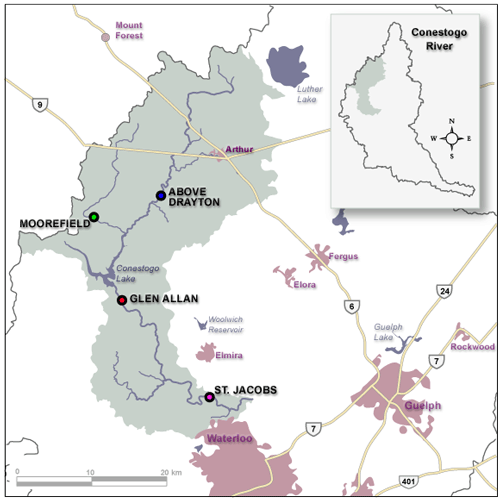
Location of flow gauges in the Conestogo River
Provisional Data
Caution: Users of the GRCA's real-time data are cautioned to consider the provisional nature of the information before using it for decisions that concern personal or public safety or the conduct of business.
The Grand River Conservation Authority assumes no responsibility for the correctness of the information contained in this website nor liability to any user of such information, regardless of the purpose.
Warning! River levels and flows can change rapidly.