
Public Information Centres (PICs) will be held in Grand Valley and Drayton upon the completion of the study to present results. Notifications will be sent once these PICs have been scheduled.
Flood Damage Assessment Study
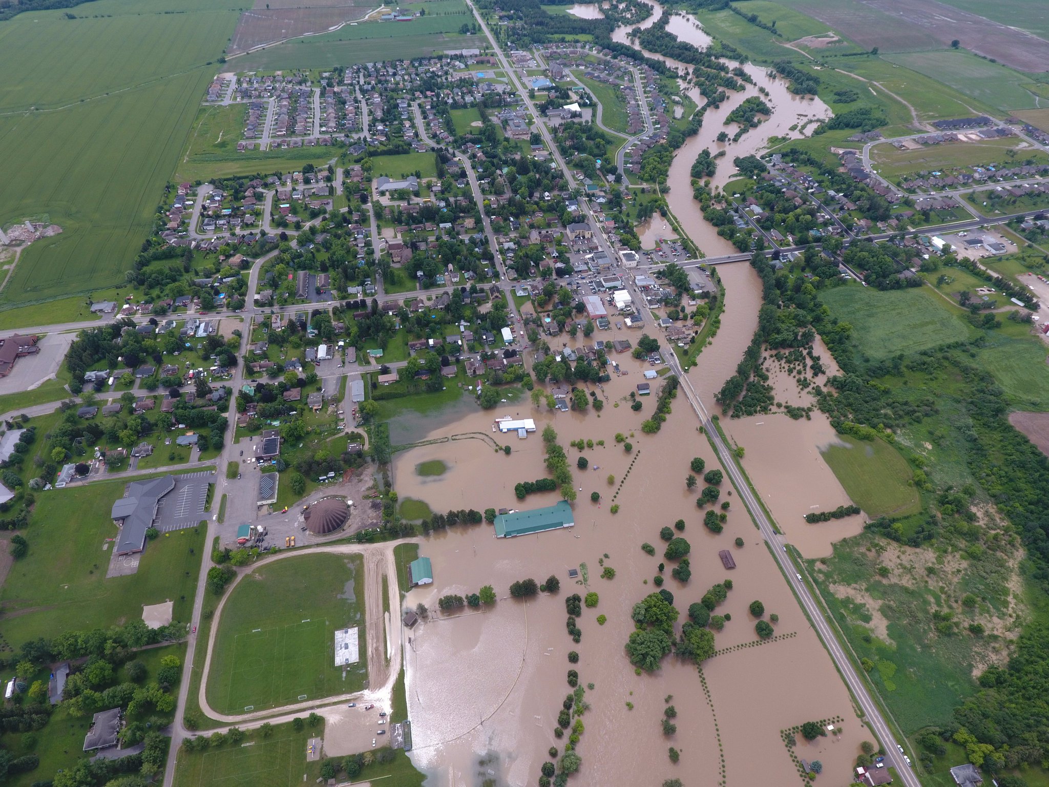
Grand Valley, Waldemar and Drayton Flood Damage Assessment Study
Funded in part through Canada’s National Disaster Mitigation Program (NDMP), the Grand River Conservation Authority (GRCA) is undertaking a Flood Damage Assessment Study for the communities of Grand Valley, Waldemar and Drayton. The objectives of the study are to estimate average annual flood damages in the three communities and to update flood hazard mapping through the Village of Drayton. The flood hazard mapping in Grand Valley and Waldemar is being updated as part of another ongoing project.
These three communities are high-risk flood damage centres, given they are located high in their drainage basins (meaning short response times to flooding), limited flood control infrastructure upstream, and the historic development in the floodplain. They are routinely subjected to nuisance flooding and have experienced consequential events in the recent past, notably in 2017, 2018, and 2020.
As part of the study, field work and background information review is expected to include the collection of bathymetric topography (i.e., the surface of the ground underwater), mapping and surveys of selected existing flood-prone buildings and infrastructure, and data related to recent flooding.
The results of this study will help the GRCA, the municipalities, and the property owners better understand and quantify flood-related impacts in these communities and may be used in possible future studies to assess the feasibility (i.e., cost benefits) of potential mitigation options to reduce flood damages.
Survey - Residents and Businesses
As valuable information for the study, the GRCA is seeking input from community residents and businesses related to the characteristics of buildings in areas of flood risk (e.g., whether basements are finished), types of flooding residents have experienced (river-related or sewer back-up), and damages and costs associated with floods.
Survey of Residents and Businesses - Deadline Friday, June 10, 2022
The online survey of residents and businesses (opens a Google form) should take no more than 5-10 minutes to complete. Responses will be shared with the GRCA's consultant, Matrix Solutions Inc., and the project team.
Hard copies of the survey are also being mailed out to residents and businesses within the floodplain in Grand Valley, Waldemar and Drayton.
The deadline to complete the survey has been extended to June 10, 2022.
This project will result in new floodplain modelling and mapping for the Conestogo River and near shore areas in Drayton. This information may result in amendments to the GRCA’s regulated area mapping under Ontario Regulation 150/06 of the Conservation Authorities Act.
The new floodplain model and mapping will also support review and potential future updates of flood warning zone mapping for Drayton.
Consultation on any changes to the regulatory floodplain and regulated area mapping will be held during the PIC that will be held for this study in the Village of Drayton.
About the National Disaster Mitigation Program
The National Disaster Mitigation Program is a federal program established in 2015 with the aim of reducing the impacts of natural disasters on Canadians. The program focuses investments on significant, recurring flood risk and costs. Public Safety Canada can fund up to 50 per cent of project costs to a maximum of $1.5 million in federal funding per project. The NDMP funding provides an important opportunity to share the cost of flood-related studies, analysis, floodplain mapping or small mitigation works.
Contact Us
Grand River Conservation Authority
400 Clyde Road, PO Box 729
Cambridge, ON
N1R 5W6
Phone: 519-621-2761
Toll Free: 1-866-900-4722
grca@grandriver.ca